


Walking tours Extratour Galgenberg
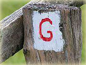
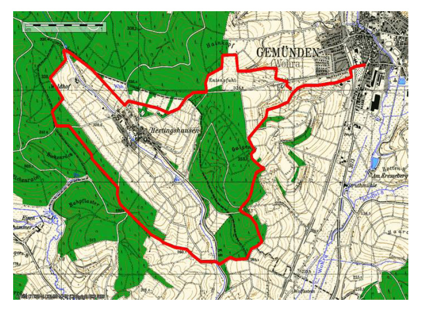
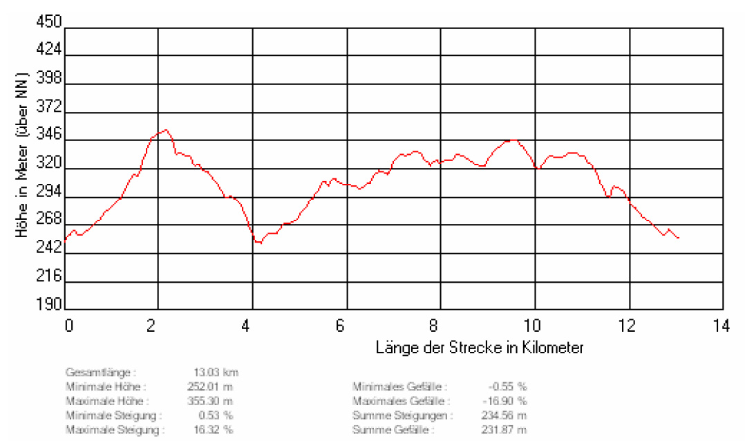
Directions: The Galgenberg extra trail is marked with a red G on a white mirror. This hike begins at the walking portal at the Diedrichskehle. With the kindergarten to your left, follow the meadow path straight ahead and follow the G markings up a slight climb to the edge of the forest. Walk to the left, always along the forest, then keep to the right and continue to follow the markings into the forest. Walk straight ahead and come to a paved forest road. Here walk to the left up to a crossroads.Go straight across and walk for about 40 metres along a narrow path to the edge of the forest. Walk right along the edge of the forest and back into the forest to reach the viewpoint and information board <Pearl>. Continue the hike and walk along the edge of the forest to cross the road from Wohra to Hertingshausen. Continue through the open field, always following the markings to reach the Kuhpflaster crossroads. Turn right here and pay attention to the Waldhof and Hertingshausen signs as well as the G.
After several hundred metres leave the well-maintained forest road and walk left always following the markings until you see the next sign. Now leave the forest road and walk right onto a path which is overgrown with moss and grass to get back onto open fields from which you can see Hertingshausen village to the right. Now continue along the forest (the Waldhof is to the right) and return to a paved forest road, paying attention again to the Hertingshausen and G signs. After about 300 metres leave the well-maintained forest road and walk in a slight left curve to the right, past an information board, along a meadow path to Hertingshausen. Directly in front of the place, keep left again following the sign for barbecue hut and Gemünden. Walk past the barbecue hut and along farm path to the forest, where you will then come to the tarred way (Gemünden after Hertingshausen). Following the curve, walk further to the left along the forest until you get back on the open field. Now walk to the right up a paved road and come to the info panel <Jewish Cemetery>. Walk further left down the hill, past the Jewish cemetery go to the right up the next farm path again until you reach the tarred way again. Now walk to the left and after about 200 metres turn right down the hill, follow the signs to the hiking portal in the Dietrichskehle.
> Walking tour Galgenberg print
Extratouren: www.ederbergland-touristik.de
Menu cart
Our menu "up to date in all seasons"
Events
We look forward to greeting you

Route map
Hotel & Restaurant Steinweg 1 35285 Gemünden
Bookings
06453-356 oder info@hessischer-hof-gemuenden.de
Hotel & Restaurant
- Hessischer Hof Gemünden
- Steinweg 1 35285 Gemünden / Wohra
- Wohratal Hessen Germany
- Route map: Routenplaner
Contact
- Fon +49 - 6453 - 356
- Mobil +49 - 160 9086 9233
- Fax +49 - 6453 - 648922
- info@hessischer-hof-gemuenden.de
Information
- Opening hours
- Data protection
- Imprint
- Social Media: Instagram
